Planning and cadastre
National Land Commission Secretariat
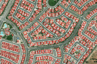
NCRP Building Footprints Category: Open
The NCRP data consists of cadastral plots comprising boundary points, boundary lines, and parcel identifier numbers (PIN). The data also consists of existing surrounding utilities and natural features such as roads, footpaths, streams, rivers, drains, irrigation channels, power lines etc and structures (building footprints). The data is merged and operates under one Geodatabase for all 20 dzongkhags. There are a total of 8 datasets including a dataset for the state land layer.
Keywords: [#ncrp#building footprint]